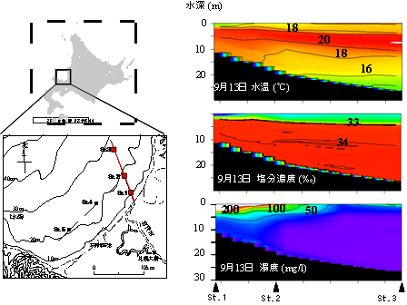
Figure.1 Temperature, salinity, turbidity, and horizontal distribution of salinity within the Ishikari Bay.
Figure.1 Temperature, salinity, turbidity, and horizontal distribution of salinity within the Ishikari Bay.
石狩川河口から流出した河川水が広範囲に影響していることがわかります.

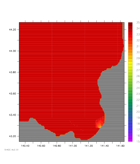
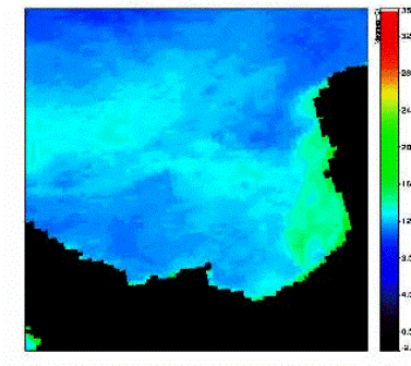 Figure.2 Satellite images (SeaDAS) within the Ishikari Bay. Left: Chlorophyll concentration; Right: Temperature.
衛星画像を使った解析により、石狩湾におけるクロロフィル(葉緑素)分布を分析し、数値計算モデルと同時に解析します。
Figure 2 はMay 22, 2003の衛星画像.
融雪に伴う河川水に対応してクロロフィルが増殖していることがわかる.